Local councils in the UK frequently alter road layouts to implement Low Traffic Neighbourhoods (LTNs) and new cycle lanes. These updates create significant logistical challenges for delivery businesses. A road that opened yesterday may close today, causing standard navigation tools to fail. To remain efficient, the best route planner app must account for these changes immediately. This prevents the extra mileage and late deliveries that eat into daily profits.
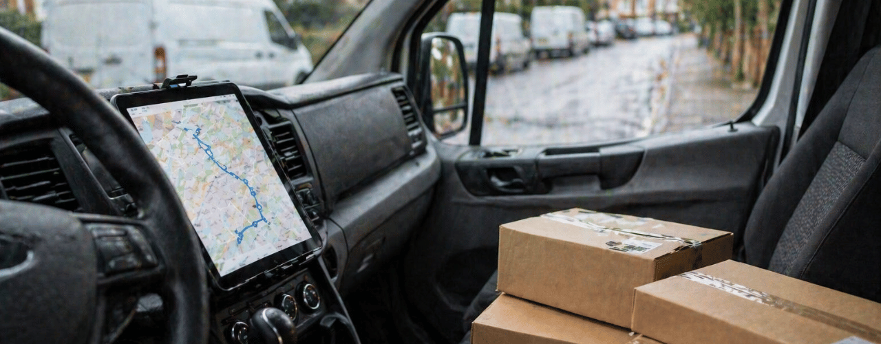
The Delm8 app provides the solution to these dynamic road changes by bridging the gap between physical street updates and digital navigation. By utilising property-level data and precise coordinate hand-offs, we ensure that fleet operations stay profitable even as local infrastructure evolves. In this guide, we explain how professional routing software manages UK road updates and why an adaptable system is essential for modern delivery work.
Why is my sat nav sending me to closed roads in the UK?
Local councils change road layouts to manage traffic or improve air quality. These changes include installing physical bollards and using camera-enforced restrictions. Industry reports from the CIHT show that many route-finding apps fail to update as quickly as physical infrastructure changes occur.
When a council modifies a layout, the new information moves slowly to standard mapping software. This delay causes systems to guide drivers toward roads they cannot legally enter. For a business, this delay results in delivery lags and traffic fines.
Pro-Tip: Navigating Road Barriers
When you approach a new LTN or “School Street,” look for blue and white signs such as “No Motor Vehicles.” Do not rely only on a phone screen. If a road contains planters or bollards, use your address finder to locate the nearest accessible street. Approaching a property from the wrong side of a barrier can force you to drive a much longer distance to reach the destination.
How do I navigate Low Traffic Neighbourhoods (LTNs) without getting a fine?
UK urban planning often employs “filtered permeability.” This method uses physical barriers to allow pedestrians and cyclists to pass while blocking vans and cars. These changes turn some residential roads into dead ends for delivery vehicles.
Standard GPS tools often show these roads as connected and route vehicles through them. Professional software identifies that a specific road prevents access for commercial vehicles. Navigating these areas requires a tool that plans the exact approach to a property. Delm8’s route planner app solves this by providing precise doorstep data, ensuring the driver arrives at the correct side of a barrier and avoids the frustration of turning around in a narrow street.
Can a route planner protect my business from AI-powered traffic fines?
Many council layouts now use digital restrictions instead of physical bollards. Councils use ANPR (Automatic Number Plate Recognition) cameras to enforce “School Streets” and restricted access zones. In 2025, these cameras became common in major cities like London and Birmingham.
A Penalty Charge Notice (PCN) costs between £65 and £130. For many couriers, one fine removes the profit earned from a full day of work. Specialist apps help drivers avoid these restricted zones. Accurate routing reduces the risk of receiving these fines by planning paths that follow current road rules.
What is the best route planner for UK council restrictions?
Developers build standard navigation apps for general use. In professional logistics, small delays caused by road closures reduce daily profit. Professional routing software manages council layout changes by allowing drivers to enter specific coordinates.
When road layouts change, a professional tool allows drivers to mark restricted points and share that information with a fleet. This prevents other drivers from making the same mistake at the same location. Delm8 ensures routes remain accurate by utilising recent road data that consumer apps often overlook. Finding the best route planner app for your specific delivery needs is essential for avoiding these local authority restrictions.
How Delm8 provides the best route planner app for evolving roads
Delm8 route planning solutions support the UK road network by focusing on the final stage of delivery.
- Precise Coordinate Hand-off: Export coordinates to a navigator to approach a property from an accessible side.
- Address Lookup Tools: Use Delm8 address lookup and finder tools to verify destinations before starting a route.
- Dynamic Database: Access a database that includes recent UK property information.
These features help businesses by reducing driver stress. When a driver follows an accurate route, they focus on driving safely. This helps fleet managers avoid accidents caused by navigation confusion.
How do I manage a delivery fleet on changing UK roads?
Managing a fleet requires a tool that handles road changes automatically. If a route planner fails to update, a fleet manager must spend time re-routing drivers manually.
The best route planner app for road changes automates this process. Integrating address data with navigation creates a workflow that accounts for current UK streets. This reduces the extra miles that drivers cover while circling blocks to find an entrance. Giving a team professional tools like Delm8 also helps keep drivers in the job. Drivers experience less frustration when they do not get stuck, which makes the workforce more stable.
Taking control of dynamic road changes
Using outdated maps when councils change roads frequently creates a risk to business profit. Time and fuel wasted on navigation errors reduce earnings.
Choosing a professional route planner helps a business manage infrastructure changes. Whether the change involves a new cycle lane or a camera restriction, your routing software should help you find the way. Our tools provide the data needed to navigate UK roads with confidence.
Download the Delm8 app today to use the best route planner app for your delivery business.