Planning delivery routes seems straightforward until your driver pulls up to a locked farm gate or takes a wrong turn down a restricted lane. When you rely on manual methods or generic mapping tools, these issues add up fast.
A postcode-to-postcode route planner helps small delivery teams plan smarter, cut wasted miles, and deliver with more confidence. postcode-to-postcode route planner. But knowing which tool to use and how to get started can be a challenge.
How to Choose the Right Postcode to Postcode Route Planner for Your Business
A postcode-to-postcode route planner must do more than map out stops; it needs to handle the day-to-day delivery challenges your team faces on real roads. When evaluating your options, look for planners that give you property-level accuracy, not just postcode clusters. This can make a big difference in how smoothly your drivers move between stops.
Choosing the right tool starts with understanding your delivery patterns. Are you servicing urban streets, rural farms, or a mix of both? Do you have different vehicles or rotating drivers?
Look for tools that:
- Go beyond postcode routing to target the exact drop location.
- Adapt to different van types, start points, and delivery window rules.
- Provide visibility to track progress and resolve issues live.
Delm8 was built for these challenges especially for delivery teams who don’t have time to troubleshoot every mile.
How Do Route Planner Apps Work and What Do They Miss?
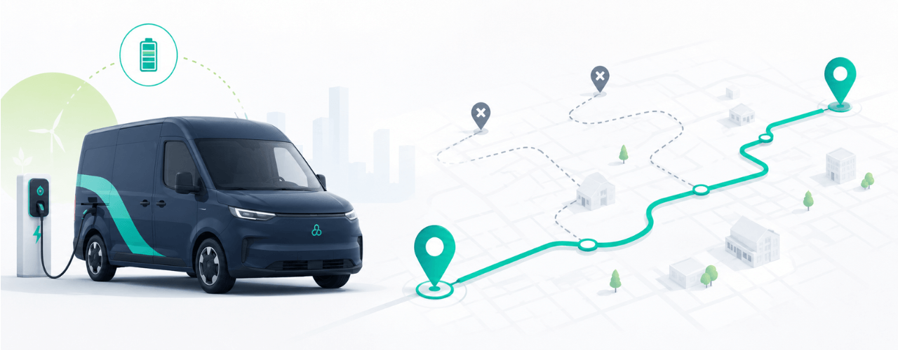
A postcode-to-postcode route planner calculates the most efficient way to travel between delivery stops by analysing postal zones. But the difference between a basic planner and a tool like Delm8 becomes obvious the moment your driver hits a dead end, struggles to find a property without signage, or wastes 10 minutes calling a customer for access.
Most generic planners rely on straight-line estimates or outdated maps. That might work on paper, but delivery teams operate on real roads with real obstacles. Real roads have traffic, low bridges, one-way zones, and properties that don’t show up on the map. Delm8 integrates real-time road data, property-level location tagging, and traffic-aware logic to build routes your drivers can follow.
Do You Have Reliable Map and Postcode Data?
It’s tempting to rely on the postcode-to-postcode method you enter a batch, click “plan,” and go. But that method ignores critical details like road restrictions, traffic flow, and delivery access. Deliveries based solely on postal codes often miss the nuances of one-way streets, narrow lanes, or timed closures.
That’s why your route planner must be fed by live data reflecting new restrictions, updated signage, and road changes your drivers deal with daily.
Are You Factoring in Stop Times and Delivery Complexity?
This is one of the biggest planning blind spots. Stop times aren’t static. A flat drop-off takes two minutes. But a parcel for a third-floor flat or an unanswered door adds unexpected delays. Before you know it, you’re 15 minutes behind and still on stop three.
Experienced teams know these delays compound fast. That’s why effective route planner apps allow you to set a default stop time that reflects typical delivery conditions such as 2–10 minutes per drop. Delm8 lets you preset that stop time in advance, so every route reflects a realistic baseline.
Are You Using the Right Vehicles for Each Route?
Not all vans belong on all roads. A long wheelbase won’t clear some low bridges. A smaller vehicle might not have capacity for large items. And in cities, length and turning radius can be the difference between a clean drop or 10 minutes lost rerouting.
When planning routes, consider how different vehicles affect access and delivery time. While Delm8 doesn’t currently offer vehicle-specific profiles based on dimensions or weight, we are compatible with apps like Sygic for Trucks which allow for entering dimensions.
How Do You Define Starting and End Points in Delivery Routing?
Some teams begin route planning from a depot, others from a mobile hub or even home. Delm8 lets you define your start and end locations whether that’s a depot, home base or temporary hub. This gives you flexibility if your team needs to begin or end routes from different places.
How Do Route Planner Apps Handle Live Tracking and ETA Updates?
It’s one thing to plan a route, but what happens if a driver hits traffic or needs to drop an extra parcel? When traffic hits or a customer cancels, live tracking gives your team the visibility to adjust routes on the fly and keep drivers moving. Make sure your app links planning with live tracking and ETA updates.
Have You Built Flexibility into Delivery Slots?
Your customers want precision. But they also want speed. The right postcode to postcode route planner helps you balance both by assigning flexible yet achievable delivery windows. Delm8 supports real-time adjustments, so if a driver’s running ahead or behind you can keep ETAs realistic and customer expectations in check. It’s one more way a postcode to postcode route planner keeps your operation smooth.
Should You Optimise All Routes Not Just the Busy Ones?
Even smaller runs benefit from planning. A postcode-to-postcode route planner that supports batch optimisation helps teams reduce inefficiencies across the board.
Some delivery teams optimise only their busiest routes, leaving smaller jobs to manual planning. But this approach creates inconsistency and risk. Delm8 helps you plan every drop from single-package jobs to full-day multi-stop runs with the same level of care and accuracy.
Why Postcode to Postcode Route Planners Fall Short Without Address-Level Accuracy
Postcodes help sort letters, not plan tight delivery runs. They often group multiple properties, leaving your driver circling or knocking on the wrong door. One rural code can cover miles of farmland. In towns, a single code might serve 30 flats. If your route planner doesn’t go beyond postal data, your drivers are wasting time looking for gates, building numbers, or driveways.
Delm8’s strength is in its precision. By linking property-level coordinates with postcode routing, it helps teams shave minutes off every drop.
What Mistakes Should Small Teams Avoid When Using Route Planning Apps?
Before adopting any postcode-to-postcode route planner, it’s important to avoid early missteps. These are the most common mistakes:
- Common pitfalls include misjudging stop delays, overlooking vehicle suitability for certain roads, using tools that lack address-level accuracy, and launching without feedback from drivers.
Begin with a smaller batch and let drivers test the routes. Use their feedback to fine-tune your setup and build trust across the team.
No one likes tools that go live and frustrate the team. Many issues come from wrong configuration or poor timing assumptions. Run a small test batch, hear from drivers, adjust stop times and access notes, then expand it gradually don’t dump it all on one launch.
Unlock Smarter Deliveries with the Right Route Planner
Good delivery planning comes from tested processes, trusted tools, and real-time feedback from the field. Whether you’re just starting out or scaling operations, using a postcode to postcode route planner like Delm8 can help you improve accuracy, reduce delays, and better support your drivers in the field..
Every planning choice from vehicle suitability to how you calculate stop durations shows up in how smoothly your team runs their route. Investing in the right software gives you control where it matters from the first route plan to the final delivery.
Start smarter today. Book your 60-minute Delm8 demo to see how precise planning, route-by-route, can help your team spend less time rerouting and more time delivering. Schedule your session.